
今天,高温警告依然生生效,加州4500万人继续开启炙烤模式。
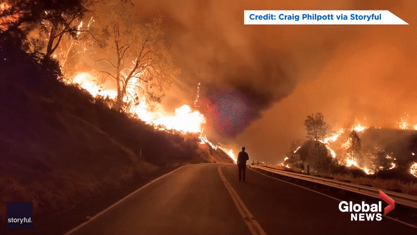
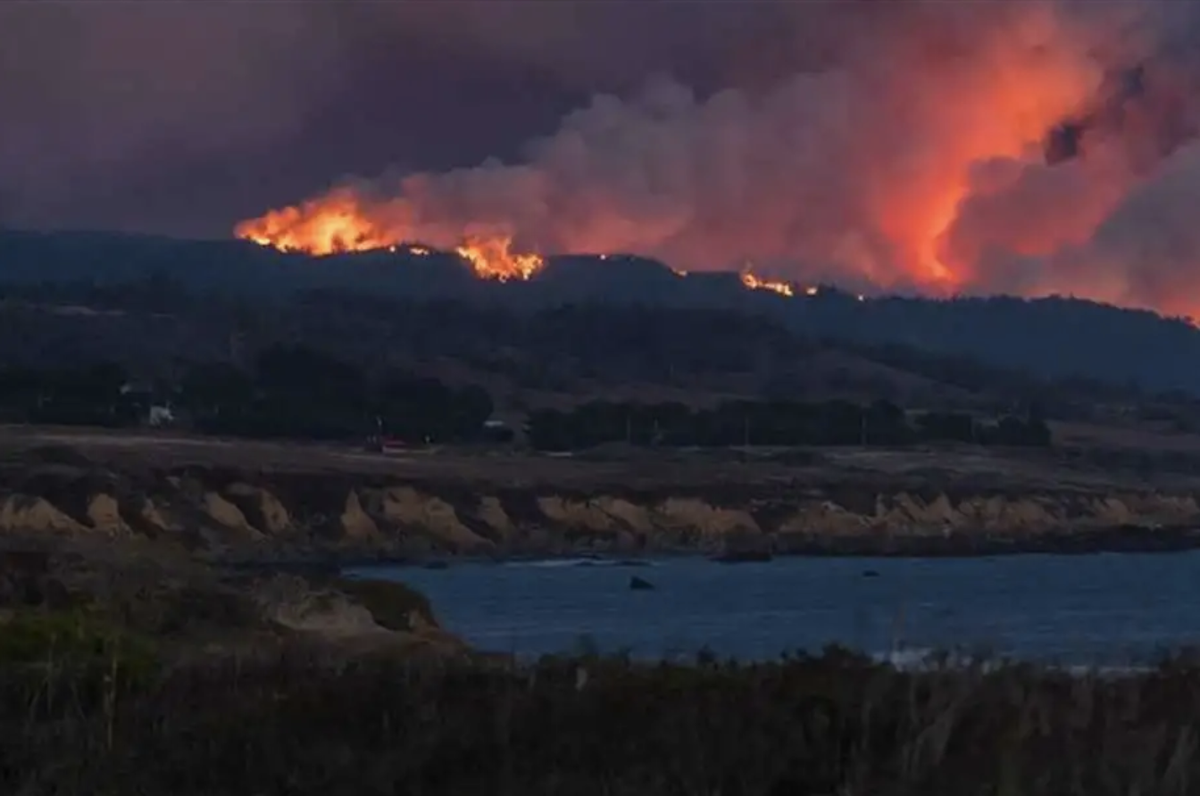
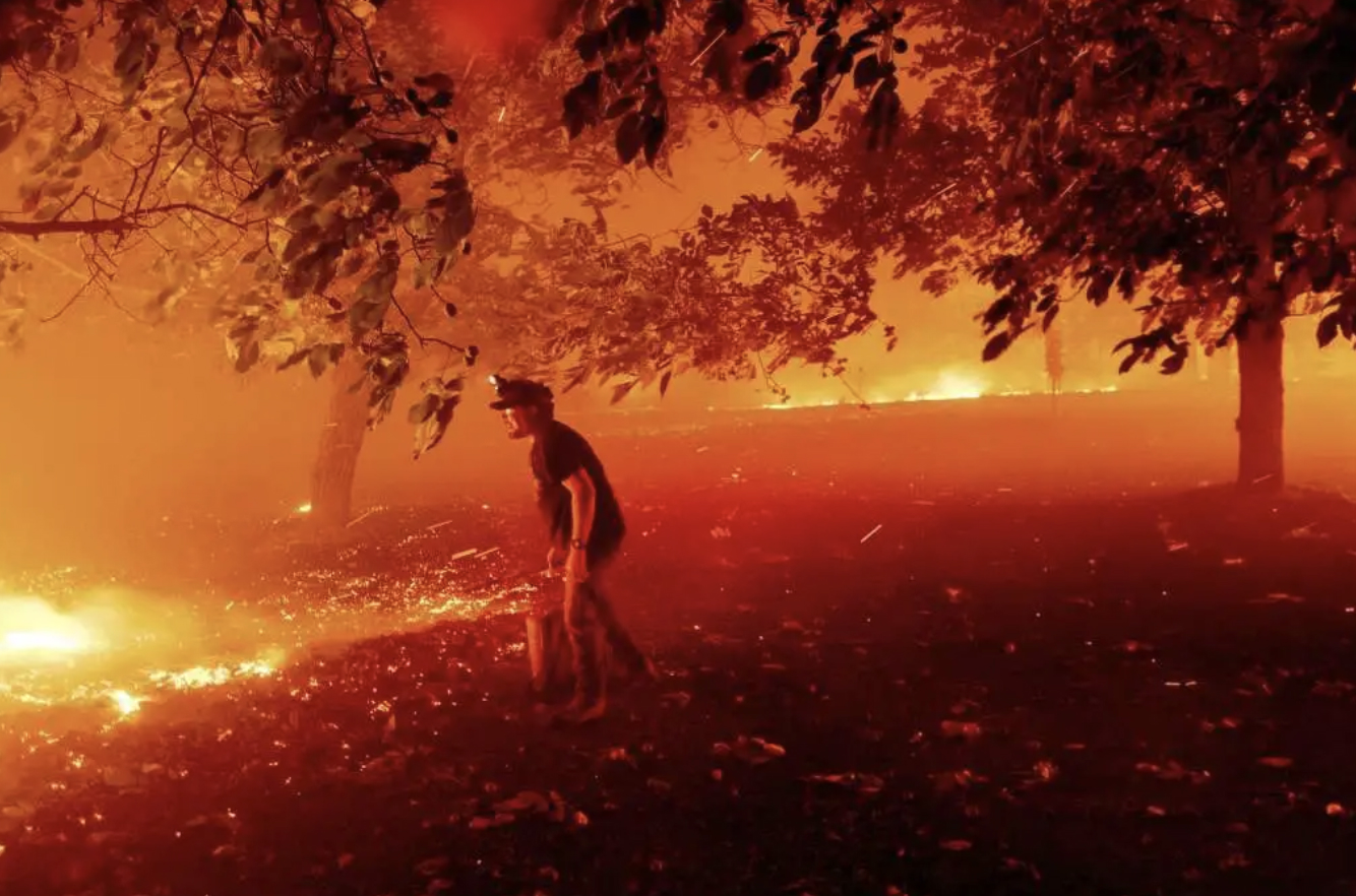
高温肆虐,山火狂烧,加州州长纽森通报,过去72小时,加州发生了约10,849次雷击,造成了367处山火,其中23处是大型山火。
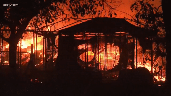
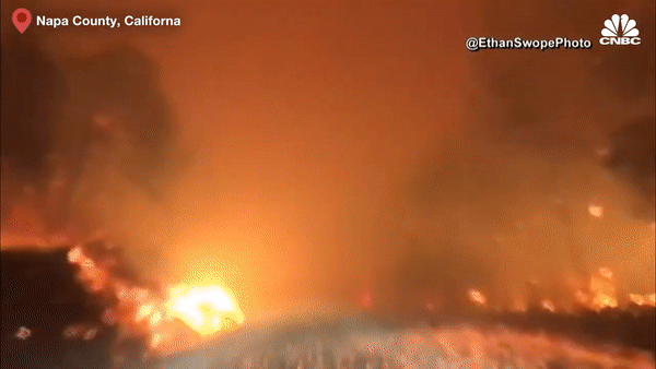
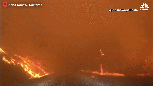
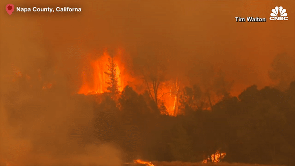
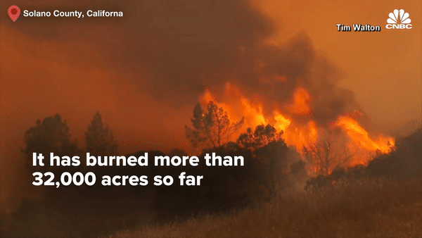
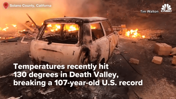
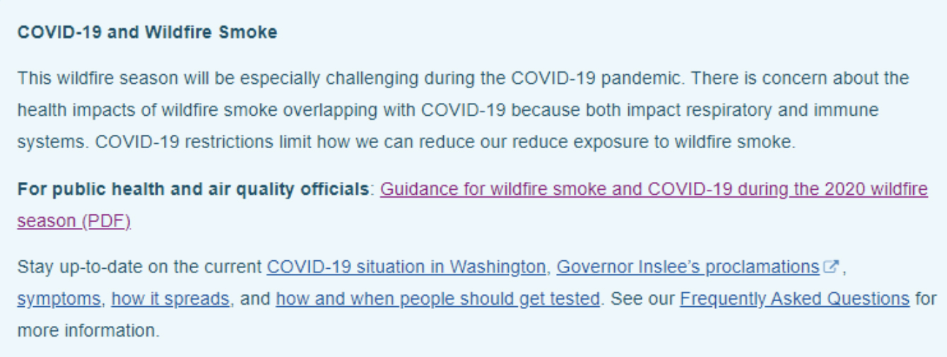
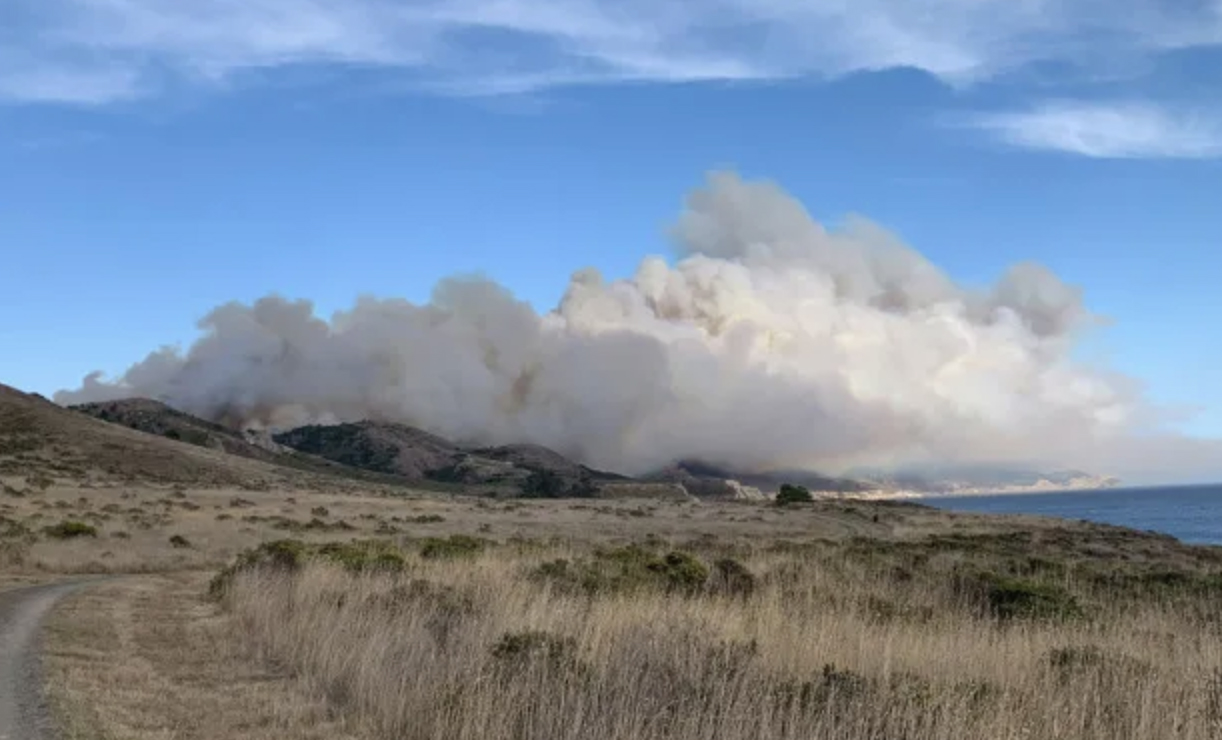
目前,加州纳帕酒乡火势失控蔓延,已烧毁 46000+ 英亩,目前北加州至少有33场山火在燃烧,烧毁面积超过14.1万英亩。连湾区著名的户外远足热门地 point reyes 也发生山火,不少徒步登山客被逼撤离。
加州 2020 再现末日山火,已进入紧急状态
州长纽森宣布,加州进入紧急状态。
山火引发烟雾蔽日,美国卫生部门警告,山火毒烟遇上新冠病毒恐更致命。烟雾可能让人更容易被病毒(包括新冠)感染,患有新冠的人病情会加重,因此需要特别注意。


加州山火,撤离、封路信息如何查询?
这里为大家汇总了一系列实用的网站,可以获得想要的各种信息
- 查看加州撤离+封路情况:https://abc7ne.ws/3hdqOJE
- 南加哪些地方关闭:https://lat.ms/3hqaQMt
- 实时山火:https://data.thecalifornian.com/fires/
- 查询 napa 酒乡山火详情:https://bit.ly/3iQZkdg
- 查询加州所有山火情况:https://bit.ly/327RTr8
- 查询你住的附近是否有山火:https://bit.ly/34olIXx
- 加州紧急服务办公室的最新消息:CalOES.ca.gov
- 当前空气质量信息:https://bit.ly/3iONEaT
- 当前空气状况图:AirNow.gov
- 有关山火延误危害的更多信息:Ready.gov
- 口罩使用查询网址:https://bit.ly/3h9SCP4
- 疫情下发生山火,如何保护自我:https://bit.ly/322iypq
加州山火对健康影响有多大
卫生部门警告,吸入野火烟雾本身就会对健康产生有害影响。
这些影响包括轻微的症状,如眼、鼻、喉刺激或头痛,到更严重的症状,如呼吸急促、胸闷、哮喘发作和恶化现有的慢性病。
其中一些呼吸道症状,包括干咳、喉咙痛和呼吸困难,也是新冠的常见症状。早期证据表明,野火烟雾暴露会使人们更容易患呼吸道感染,可能包括新冠。
最近的研究表明,空气质量差可使COVID-19患者的症状和结果更加严重。
哪些人是山火敏感人群
有心脏和肺部疾病、呼吸道感染、糖尿病患者、脑卒中幸存者、婴儿、儿童、孕妇和65岁以上的人,对山火容易敏感,他们也是新冠的易感人群。
此外,由于肺部和心脏功能受损,吸入山火烟雾后,患有新冠或正在康复中的人可能对健康产生负面影响。
应当如何应对加州山火
- 待在室内,保持室内空气清洁
- 当山火烟雾导致空气质量差时,要减少户外体育活动。
- 当外面烟雾弥漫时,要关闭门窗。
- 注意防暑降温,室内要采取措施保持凉爽,期间要拉上窗帘。
- 日光,使用空调或风扇。如果还是太热,就开窗避暑。
- 将空调设置为再循环,防止吸入外界空气。
- 关闭向外排气的风扇,比如浴室里的风扇。排气扇拉,或从门窗周围的缝隙进入外部空气。
- 不要增加室内空气污染。避免以下活动。
- 焚烧蜡烛或香、吸烟、烧烤或油炸食物
- 不要使用便宜的“防毒面具”或“外科口罩”。如果买口罩,请购买上面印有“NIOSH”字样的“N95”或“P100”的“particulate respirator”(颗粒物口罩),这些口罩有2个带子,可以固定在头部的,这些口罩可以阻挡至少95%的细小微粒。
加州山火撤离和封路汇总
目前,北加州是加州山火的重灾区,主要火场分布在三大片区
Napa, Sonoma, Solano 县 – LNU片区
地点:Napa, Sonoma, Solano县,包括正在进行疏散的Vacaville市。
有8场大火,燃烧面积超过46000英亩。
火势未被控制
疏散令
Napa County:
- Wragg Canyon Rd – from Hwy 128 to the end of the road, including Pleasure Cove Resort
Chiles Pope Valley Road – From Lower Chiles Valley Road to Pope Canyon Road - All of Berryessa Knoxville Road from the intersection with Highway 128 (southwest of Lake Berryessa) to the intersection with Eastside Road (northeast of the lake)
- Everything immediately west of Lake Berryessa
- Pope Canyon Road from Pope Valley Road to Berryessa Knoxville Road
- From Moskowite Corner to Wooden Valley Road, including the community of Circle Oaks
Atlas Peak from the Bubbing Well Pet Cemetary at 2462 Atlas Peak Rd. to the dead end - From Loma Vista Drive and Soda Canyon Road to the dead end
- Snell Valley Road from Butts Canyon Road to Spanish Valley Trail, including the Berryessa estates
- Highway 128 from Lower Chiles Valley Road to Monticello Road
- Highway 128 from Chiles Pope Valley Road to Lower Chiles Valley Road
- Chiles Pope Valley Road from Highway 128 to Lower Chiles Valley Road
- All of Hennessey Ridge Road
Sonoma County:
- North of Austin Creek Recreational Area
- East of The Cedars
- West of end of Mill Creek Road
- South of Stewarts Point-Skaggs Springs Road
- West of West Dry Creek Road and Westside Road
- North of Sweetwater Springs Road and McCray Ridge Road
- East of the East Austin Creek (the actual creek)
Solano County:
- West of Blue Ridge Road to Interstate 505 and north of Cherry Glenn Road Highway 128
Pleasants Valley Road - Quail Canyon, Miller Canyon, Mix Canyon and Gates Canyon areas
封路:
- Highway 128
- Sage Canyon Road
- Chiles Pope Valley Road
- Lower Chiles Valley Road
Santa Clara 县 – SCU 片区
主要集中在在 Santa Clara 县。
有20个着火点,烧毁了85,000英亩的土地。超过1400座建筑受到火焰的威胁,至少有两名急救人员在此次事件中受伤。
疏散令
Alameda/Stanislaus County:
- Frank Rains Park to Mines Road
- Del Puerto Canyon Road 1 mile to Mines Road
Alameda County:
- Welch Creek Road
Contra Costa County:
- Marsh Creek Road at Round Valley to Morgan Territory
- All of Morgan Territory and the mobile home park on Marsh Creek Road
Santa Clara County:
- North of Hwy 130 to Santa Clara County Line
- West of San Antonio Valley Road
- West of Mines Road to Santa Clara County line
- East of 3 Springs Road and Mt. Hamilton Road
- South of Santa Clara County Line
封路
- Marsh Creek Road between Morgan Territory Road and Deer Valley Road
- Del Puerto Canyon Road (SR-130) between Mines Road and Diablo Grande Parkway
- Hwy 130 at Three Springs Rd.
- Hwy 130 at Quinby Rd.
San Mateo 和 Santa Cruz – CZU片区
地点:San Mateo 和 Santa Cruz
由5个大型着火点,燃烧面积约1万英亩,未被控制。目前已派出近600名人员和7架直升机,有3名急救人员在扑救这些大火时受伤。
疏散令
San Mateo
- Butano Community Area
- Community of Loma Mar
- Dearborn Park
- Pescadero Creek County Park
- Butano State Park area including Barranca Knolls community
- Butano Creek drainage area
- South Skyline Blvd.
- Russian Ridge Open Space Reserve
- Middleton Tract Area
- Portola Redwoods State Park & Portola Heights Community Area
Santa Cruz
- Waterman Gap Loop
- Upper 236
- Boulder Creek Golf Course
- Heartwood Hill
- Lodge Road
- Community of Little Basin
- Lower China Grade
- Upper China Grade
- Community of Kings Hwy
- Lower Jamison Creek
- Gallion Heights
- Fallen Leaf Neighborhood
- Foxglove Lane
- Last Chance
- Big Basin State Park
- Las Cumbres
封路
San Mateo County
- Pescadero Creek Road betw. Alpine and Cloverdale Road
- Cloverdale Road betw. Pescadero Creek Road and Gazos Creek
- Alpine Road betw. Pescadero Creek and Skyline
- Whitehouse Canyon Road at Highway 1
- Portola Heights Road at Skyline
Santa Cruz County
- Highway 236 betw. Highway 9 and Jamison Creek
- Highway 9 between Skyline and Western Avenue
ref:
https://www.doh.wa.gov/Portals/1/Documents/1600/coronavirus/WFSCOVID_Recommendations.pdf